Wednesday, July 11, 2012

Days 3 & 4 in Glacier National Park

Saturday was a beautiful day starting out temperatures in the mid 40's with a chance of reaching a whopping 70. What a change in weather since our triple digit days in the south. Ahhh, just smell that fresh mountain air. You have to remember we are still over 1.3 miles high (7,000 – 9,000 feet) so the altitude affects our breathing and how fast we can do anything. We took the scenic drive on the Going to the Sun Road. This road runs from the east to west side of the Park and was a “miracle road” when built in the early 1900's. There could be road construction with possible delays of up to 30 minutes on this road. We started out early in the morning and already there was lots of traffic in the park.  
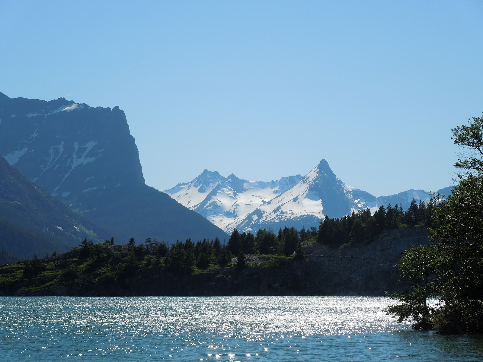
Wild Goose Island


The first few miles of the road we had already traveled, but after a while we are in a whole different terrain. We made a few stops on the way and when we arrived at Logan Pass Visitor Center, there was no room to park so we just continued on.
Too much rock to blow away


Glacial snow pack overhanging roadway


From Logan Pass westward the terrain changes and the road narrows. It is in that area where we found we had two construction zones. Driving through this area, steep grades, switch backs and s-curves is like walking under the mountain, the rocks/cliffs extended out over the roadway and it is so narrow that Tom could reach out and touch the mountain.


About every corner you turned was another waterfall, deep gorge or just spectular ahhhing and ohhhing scenery. 
Our photos show some of the scenes, but they don't fully show why this park is called The Crown of the Continent. It spoils you for seeing anything else.    
Nancy with some fantastic scenery

Sunday July 1 found us staying around the campsite. Tom said we had been on the go enough and needed a day off! We would spend a total of 8 days in the park.

Sunday, July 1, 2012

Glacier Day 2

 Friday started out cloudy, chilly, windy and did not promise for a nice day here in the states. So we went to Canada. The part of the park in Canada is Waterton, and the correct name for the park up there is Waterton Glacier International Peace Paark. We headed north to Babb and another entrance to the Park but were still in the States. Onward and northward to the border. We had our passports and all the necessary papers for Charley. We went around Chief Mountain which is certainly something to see....sticks up in the sky so high.

Canadian Entrance

Chief Mt. Higher than all the rest!


The Canadian park is much smaller than the State side of the park but we managed to take it all in on the one day. You can spot this lodge from miles away and when we were much closer we found out it is the magnificent looking, 7 story, 5 star, Prince of Wales Hotel. The falls right in Waterton, Alberta are beautiful and yes we took lots of photos. Neat little town but really high prices!!! Fortunately we had packed a lunch. A good thing too, as nothing on any menus we saw was lower than $13.00 and everything was ala carte. The sun was shining for most of our day in Canada, so it made for and enjoyable trip.

Little building in the distance.
is really a 5 Star Resort Hotel


Tom and Charlie ... pooped
Coming back into the states the lines at customs moved really slow. But we got in with no problem. All along the road you see signs saying Range Cattle....that means cattle here have free range and you may encounter them on the road, and we did. Friday evening, after dinner, back at the motorhome, we went out to Many Glacier to see if we could spot any of the wildlife that abound here in the park. The best time to spot wildlife is at dawn and dusk. We listened to a Park Ranger Talk about the geology of the area. Yes we did see 2 large black bears and 1 mule deer. We have certainly adjusted to the time difference here. We find it easy to go to bed at 10:00 and awake at 8:00! The cool evenings and cool days really make a difference compared to the triple digit temps we had seen down South.
Those noted Range Cattle


Glacier Day 1

Thursday morning, June 28th, we left Helena, MT. headed for St. Mary, MT. We stopped alongside the roadway when we neared Browning to take in our first sighting of the mountains of Glacier NP in the distance.

First glimpse of Glacier NP
Closer to the fence


We left Browning on US 89 and discovered the road is terrible to drive a motorhome or even a car or a pickup on. It has NO shoulder, NO guardrails and the road is full of potholes and terrible patchwork on parts of it. Not the best way to drive into a National Park. But we persevere and finally arrive at the campground. Our campsite is right outside Glacier National Park. When we meet John at check-in he tells us there was a much nicer drive in but nobody told us about it before coming! John showed us on his “Cheat Sheet”, we have the best view in the entire campground. Right out the big picture window (windshield) we can see the mountains and passes. Wow, it is great!  
Along St Mary Lake
Its been a long drive,
nut we finally made it!!

Along Going to the Sun Highway
Just looking a little different direction


Peaceful, easy feeling

Well, we don't want any grass to grow under our feet so we head out for a short 5 mile drive into the park. We find a great little picnic area and walk down the path towards St. Mary Lake. We walk along the lake and see great sites and take lots of pictures. Bears are a serious concern in Glacier. Nancy was talking, singing and whatever …. just like the literature says to do. Then we headed back to the campground and RV for dinner.
Sunset from our Living Room Window


Wednesday, June 27, 2012

Ogden, UT and Helena, MT

We apparently like to travel on Sundays and Mondays we left Hurricane on Sunday and drove to Ogden, Utah. That was a lot of traveling. Almost 340 miles. We stayed 2 nights, leaving a day to explore. Monday in Ogden, what should we do? Look for Donny & Marie? Find a Mormon Tabernacle? Well the old Southern Pacific Union Station is now a museum of Railroad and Automobile memorabilia. So off we went for an adventure. They have actual Southern Pacific and Union Pacific train engines and old autos. The old train station is restored to its old world charm beautifully. What a great museum. 
Gold Spike from Promontory Point
in a sealed chamber


Remember when the railroads joined together in Utah at Promontory Point? The actual gold spike is in this museum where the two railroads met.
White Pine timbers to build many
tressle bridges are from Michigan


Tuesday had us on the road again. This time a really tough, hard drive, some 340 miles in some really heavy cross-winds of up to 45 mph, to Helena, Montana. The mountain expressway roads are something else, too. Once we found a park to stay in it was smooth sailing. Fortunately, the 6000 acre brush/forest fire SW of our campsite was just far enough South of us that we didn't have a smoke issue. Wednesday morning ….. what should we do??? Yup, it's the state capitol so we tour another State Capital Building.
Montana State Capitol Building
Helena, Montana

This one was just o.k. Not as good as any of the others we have visited. But we must remember that Montana is still a great state. Never saw their State Seal. Guess they don't have one. Their Legislature, House and Senate only meet for 90 days every other year. Wouldn't that be a great plan for our Federal Government in Washington, DC?? Montana has a cash surplus to boot!!


Senate Chamber
House Chamber


Panoramic view of Helena, Montana


Tomorrow, we're off to Glacier National Park, possibly Bamff National Park in Canada, too and probably won't post anything new 'til late next week.

Hurricane, UT and Zion NP


Brigham Young's Winter Home
St George, Utah
Still in Hurricane, Utah on Thursday. Since this is not a day for us visit a National Park we thought it might be interesting to go into St. George, Utah. This is where Brigham Young had a winter home. So off we went for this adventure. The home is very well preserved museum and not at all like I thought it might be. When Brigham Young was in St. George he only brought one wife with him. So it is much like any home that one might have lived in during that time.


On the way out to Zion National Park from Hurricane, Utah, this is what we drove thru !!!
Looking out the Passenger side window
View out the drivers window


Friday, ah, our day to head into Zion National Park. As I mentioned before we had driven through part of the Park on Wednesday coming home from Bryce Canyon. This time, Charley stayed at home in A/C comfort. 

We packed a lunch and drove into the visitor's center. From there we boarded a bus into the park where they only allow buses to travel. We went to the end of the line called “Temple of Sinawave”. From there it is at least a mile hike back into the canyon to a spot called “The Narrows”.

Nancy on the "hike"
note her cane!


Tom made it ¾ of the way in and Nancy went all the way to the Narrows. If you want to go all the way farther in, to where the Virgin River starts it is 15 miles over rock riverbed. The 1 mile walk in and back is up and down hills and around lots of bends. Really trying. We made it back and on the bus we took a couple of other stops to see the sights. Zion National Park is absolutely beautiful. The scenery is spectacular and around every curve in the road another beautiful site awaits you.


Massive, rugged Zion NP


Max heat for our stay in Hurricane was 109, not including the day of the brush fire at the top of the mountain right behind our RV. Tom sat and watched many, many helicopter deliveries of water dumped on the flames at the top of the hill. They dipped it from the lake in 1000 gal lifts. Quite impressive!!
Lake by our campsite
That cloud is really smoke from a
too nearby brush fire.


Saturday, June 23, 2012

Bryce Canyon - June 20th

Another beautiful, sunny Utah morning and we are off to another National Park destination. This time it's going to be Bryce Canyon National Park. Today it's only supposed to be about 60 miles one way. WRONG! We drive North on I-15 to Cedar City and take State Route 14 to Bryce. 5 miles of spectacular scenery on a twisting, mountainous state route and ….... road repairs! A rock slide had the road closed , probably for the next month. Back out to I-15 and North another 35 miles and a different route into Bryce. Eventually a total of 115 miles instead of the originally expected 60, we are entering Bryce Canyon National Park. It turned out to be well worth the extra miles though.
Roadway arch on way into Bryce

While on the way we went thru a stone archway over the road. Yup, Nancy just had to take photos.
Highest walking elevation in Bryce.
Breathless to say the least!!


When we entered the park we decided to go to Bryce Point first. It was lunchtime and we thought we would find a picnic table to eat at ....no luck, so we ate in the car. Then about one mile down the road, yup a picnic area. Nancy, then read the park literature and discovered the Canyon was only 18 miles long. So we drove to the far end and headed back stopping at most points of interest.

A natural Arch
Used to be another arch here, too.


These are "Hoodoo


So are these
I can't begin to tell you how magnificent the “hoodoos” are. Hoodoos are the pinnacles of rock that rise 100's of feet but are only a few feet in diameter. They are everywhere and are just, soooo cool. The canyon is lots of red and multicolored sandstone and when the walls and formations go from shade to sunshine are just so different. Someone told me this was a must see National Park and I now believe they were correct. The scenes are so different and varied it just takes your breath away.


More Hoodoos


Hoodoos, Hoodoos everywhere!


On our way home we thought we would drive thru Zion National Park as it was the closest way home. When we entered Zion at the east end we were surprised at the different scenery. We didn't have a chance to stop due to the narrow roadway and terrain. We planned Zion for a trip on Friday anyways. On our way through the park we drove through two different tunnels. The second one was over a mile long, and was 11' 9” high on the side but in the very center was 13'4” high. If a trailer or motorhome needed to go thru they had to have an escort which stopped traffic through the tunnel. The switchbacks and elevation changes down into the canyon were totally unexpected and almost unbelievable. It was so warm down there that we didn't stop even when we had the chance.


Once again you can guess by all our other statements the temperatures once again were triple digits. Most days reaching at least 105, we were really glad to get back home and sit around and be a vegetable for the remainder of the day.

North Rim Grand Canyon - June 18th


We are going to the North Rim of the Grand Canyon today. Our campsite is outside of Hurricane, Utah, about 145 miles away. We got an early start. The weather was perfect. Our drive was uneventful but certainly beautiful and different scenery.
2 more Franklins at the North Rim
At a rest area we pulled off the road because there was a 1929 Franklin automobile parked. Talking with a woman there, we learned that the National Franklin Auto Club was having a rendezvous at the north rim. Imagine our surprise that we would get to see autos from the time frame that the Grand Canyon was opening up commerce to the public.
.
1929 Franklin - Stranded with fuel pump issue


Waiting for the entrance to open


The entrance to the South Rim you travel through miles of desert-like terrain with open spaces and tumbleweed....much what you might expect from watching old cowboy and indian movies. The North Rim is not like that at all. You enter through a mountainous forest with minimal, but lush undergrowth and a lot of wide open grazing lands. The road signs warn to beware of Buffalo, Cow, Deer, Elk and smaller animals. The North Rim is much more to my liking than the entrance to the South Rim.  


The North Rim Lodge

The canyon scenery here is not as spectacular as the south rim but I still loved it. The actual park trails on the North are not as “commercialized” as the South. The access is really off the beaten path, so to speak. We found a lovely setting overlooking the Grand Canyon where we sat down for our picnic lunch. Perfect. The lodge, nearby, was built in the early 1900's as are most of the cabins on the North Rim.


View from the Lodge

Down one of the trails


As with all our days lately the temperatures had started to climb before we headed home. The triple digit heat in Nevada and Utah is terrible. Don't ever believe that “but it's a Dry Heat!” junk. I will probably say that too often!!!!, Sorry.